|
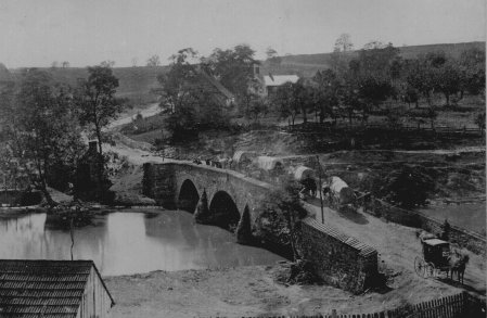
Antietam Battlefield: BURNSIDE BRIDGE |
Washington, DC 20408 and located at http://gopher.nara.gov:70/Oh/inform/dc/audvis/still/civwar.html |
|
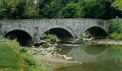
Antietam Battlefield: BURNSIDE BRIDGE |
Washington, DC 20408 and located at http://gopher.nara.gov:70/Oh/inform/dc/audvis/still/civwar.html |
| General McClellan later claimed that he had urged Burnside to storm the bridge in order to command the surrounding heights and inflict heavy losses on the retreating General Lee. Burnside countered with the claim that the order to move his 50 cannons and 12,000 men came too late to send the rebels packing. It took Burnside two attempts over three hours for his men to defeat the Georgia sharpshooters and 2000 additional Confederate riflemen and take the bridge. The Rebels had been strengthened by the forces of A.P. Hill, who had trekked the 17 miles from Harper's Ferry in seven hours. |
|
|
The battle represented the South's last chance at a meaningful offensive against the Army of the Potomac. History will hold the Battle of Antietam, and the fighting at Burnside Bridge, as the crest of the South's threat against the Union.
Burnside Bridge is 1 of the 14 stone-arch bridges built between 1823-1863.
This very narrow bridge rest over the Antietam Creek. Burnside Bridge was
constructed under the Washington County Government for $2,390.
|
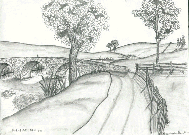
The sketch at left was submitted by Ben B., a senior at NHHS. Click on the thumbnail to see a 178 KB close-up of Ben's work. Use your browser's "back" button to return to this page. |
ABOUT YOUR VISIT
Antietam National Battlefield lies north and east of Sharpsburg, along Md. 34 and 65. Both routes intersect either U.S. 40 and 40A and Int.70. The visitors center is open daily except Thanksgiving Day, Christmas, and New Years. Most tour routes are wheelchair accessible. While touring the park, be alert to all traffic. If riding a bike, you should use caution when descending from a hill. Please use trails to avoid contact with snakes, stinging nettles, and ticks. Do not climb on cannons, monuments, fences or trees. Do not spoil your visit with an accident.
NOTE: HUNTING FOR RELICS IS PROHIBITED.
To The Interactive Atlas of Western Maryland
|
To The Antietam Battlefield Page |
George Cassutto's Cyberlearning World
[Lesson Plan of the Day] [Cassutto Memorial] [About the Author] [Search] [Civics Lesson Plans]